By Princewill Ubani · Published
Research ID: PA-ART-sungbos-eredo-nigeria-walled-city
Sungbo's Eredo: A 100-Mile Wall in Nigeria That Took a Century to Rediscover
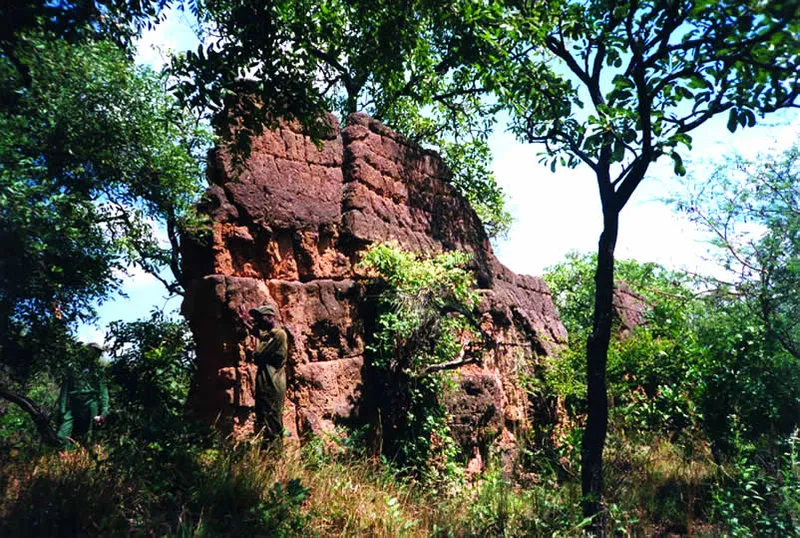
In the forested Ijebu region of southwestern Nigeria lies one of precolonial Africa’s largest known engineering projects, a system of earthen walls and ditches stretching more than 160 kilometers, roughly 100 miles, and enclosing an area of about 1,000 square kilometers around the town of Ijebu-Ode. Local oral tradition attributes the earthworks to Oloye Bilikisu Sungbo, a wealthy noblewoman remembered in Ijebu history, and the site carries her name today: Sungbo’s Eredo, from the Yoruba word for “ditch” or “trench.”
The scale involved is what draws comparisons to Egypt’s most famous monument. Some estimates of the volume of earth moved to construct Eredo’s combined walls and ditches, in places up to 20 meters from ditch bottom to wall top, exceed the volume of material used to build the Great Pyramid of Giza, though the two projects served entirely different purposes: one a single tomb built upward from cut stone, the other a defensive and boundary-marking earthwork built by digging down and piling the excavated soil into ramparts across a vast perimeter. Archaeological dating places construction in the roughly 11th to 13th centuries AD, positioning it as evidence of a substantial, organized precolonial Yoruba polity in the region well before the era of Atlantic trade with Europeans began reshaping West African coastal societies.
Despite its size, Eredo went largely unrecognized by outside researchers for most of the 20th century, obscured by dense forest growth that had reclaimed long stretches of the walls and ditches over the centuries. British archaeologist Patrick Darling, working with local communities and researchers, completed the first full survey and measurement of the earthworks in 1998 and 1999, mapping sections that had never been formally documented and bringing international attention to a monument local Ijebu communities had never actually forgotten, even as it stayed largely unknown beyond the region. Darling’s publicity campaign to preserve the site and seek greater recognition for it drew global media coverage at the time, framing Eredo, not always accurately, as a wholly new “discovery” rather than the rediscovery, by outside archaeology, of a monument with a continuous local history and oral tradition attached to it.
Eredo’s purpose is understood in general terms, likely serving defensive functions during a period of regional political consolidation and conflict, as well as marking territorial boundaries, but many specifics remain under active study, including the precise chronology of its different construction phases and its full relationship to other, smaller ditch-and-wall systems found elsewhere in Yorubaland. Continued archaeological survey work, including more recent LiDAR-based mapping efforts, has kept refining the picture of what remains one of the largest single monuments built anywhere in precolonial sub-Saharan Africa.